Client
The Austrian Space Forum, in Innsbruck, defines itself as a network of space professionals and people with a passion for space. One of its members, Dr. Gernot Groomer, has had a lifelong dream: finding life in outer space. Not too ambitious, wouldn’t you say?
Requirements & Context
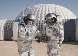
In this quest, Groomer and his team set out to build the ultimate spacesuit, one that can withstand the treacherous environment that Mars manned-missions will encounter on the surface of the red planet: essentially, a wearable spaceship.
A key element of Groomer’s spacesuit design is the Head-up display, a navigation tool that renders a map of the surrounding area for the astronaut, providing enhanced spatial awareness and conveying information related to points of interest and traversal data as generated from the base station. To develop the unconventional software for this very unconventional purpose, Groomer’s team reached out to Manas.Tech.
We were charged with the exciting and challenging task of designing and developing the mapping and navigation interface for the Head-Up Display in the OeWF-spacesuit simulator’s helmet, making use of our design experience around resource constrained scenarios, combined with GIS, performant graphics rendering techniques, and software design for embedded platforms.
Approach
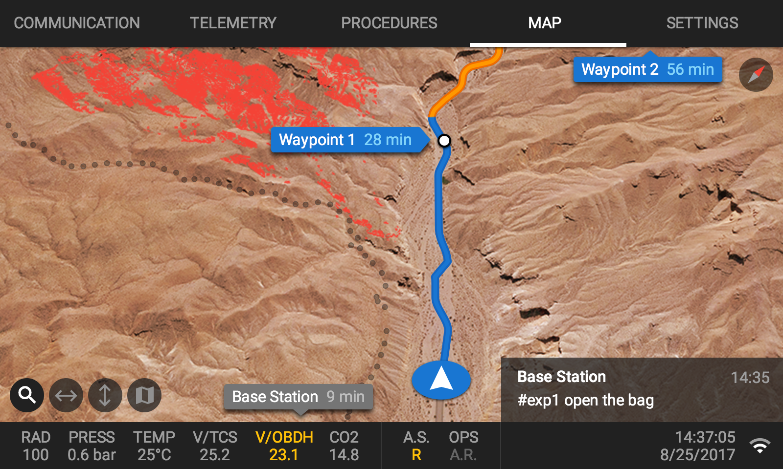
We developed a simple, intuitive UI, consisting mainly of a map view with useful data that correlates to the current location. The UI is updated in real time, whenever a new rendered map image is available. These new renders are triggered by the positioning system location updates, user actions involving zooming and panning, or new map data fetched asynchronously.
The user interface for the Head-up Display was designed with the purpose of providing the right information at the right time, so the key was maintaining a balance between availability of useful data, and a clean, clutter-free user experience. The end result was a simple, interactive map, that displays relevant topographic, weather and navigation data in real time.
Point of view
The UI allows actions like zooming and panning, and the display adjusts to the point of view of the astronaut.
Map
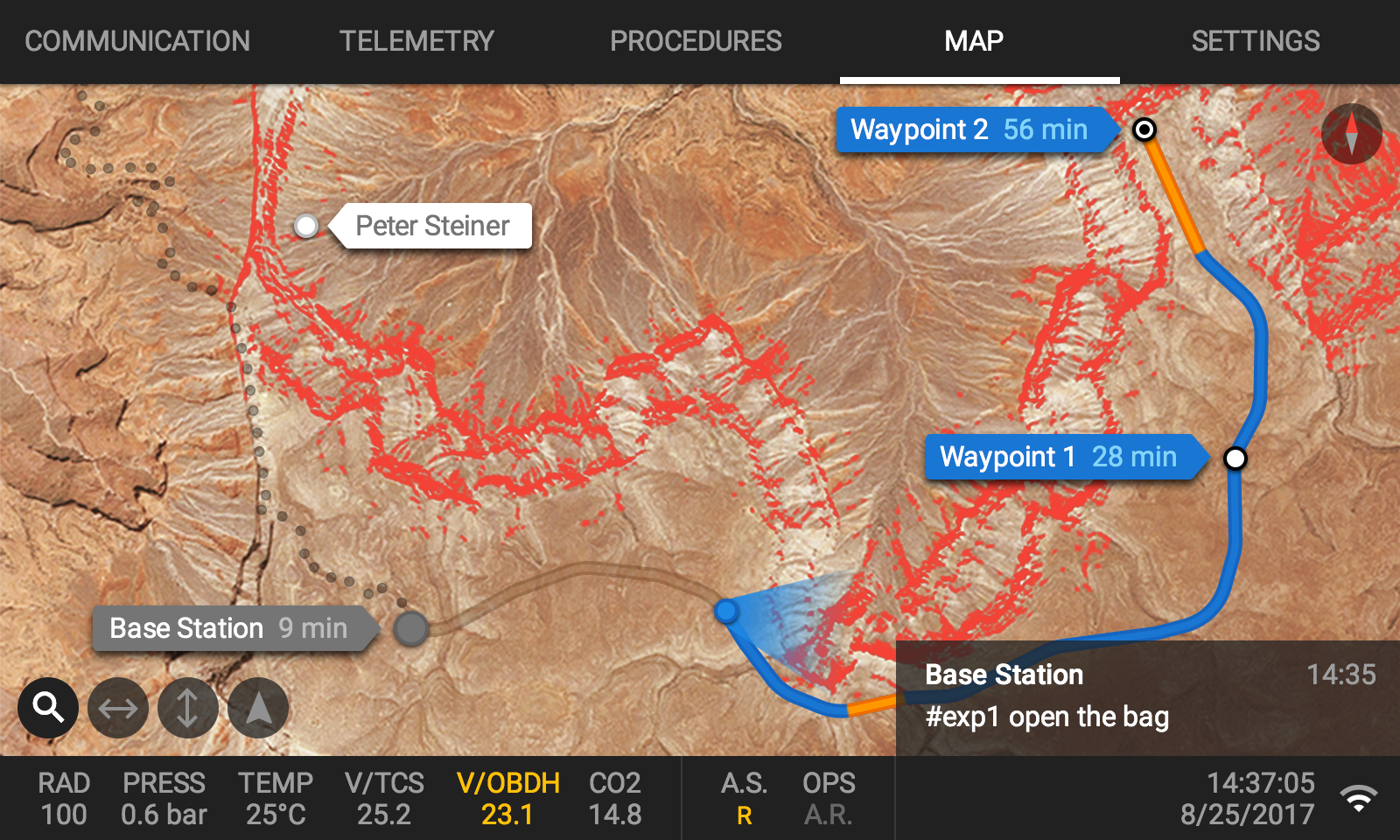
The map shows points of interest, different pathway options, and information about the terrain, the location of the base and the location of other members of the crew.
Results
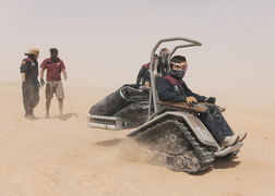
In February 2018, the Austrian Space Forum partnered up with the Oman National Steering Committee for AMADEE-18 to conduct a field simulation in the Dhofar desert, since it resembles many of the characteristics of the Martian terrain. This was the first test-drive of our Head-up display in the field, and it looked something like this:
Special shout out to @manastech. Do you recognize your software implementation on our #simulateMars head-up display? #AMADEE18 (Photo: @voggeneder ) https://x.com/oewf/status/965201813841604609
— Austr. Space Forum (@Boewf) February 18, 2018
Directed by a Mission Support Center in Austria, a small field crew conducted experiments in the fields of engineering, planetary surface operations, astrobiology, geophysics/geology, life sciences and others, in preparation for future human missions to Mars. So, you know, we’ll see you up there!
Impact
Good ideas lead to good projects, and good projects (luckily) lead to media picking up on it:
The spacesuit inspired by medieval armor, made for walking on Mars
Jan 30, 2014 by Matthew Ponsford and Nick GlassThe Evolution of the Spacesuit: From the Project Mercury Suit to the Aouda.X Human-Machine Interface
May 18, 2018 by Saoirse KerriganAMADEE-18 Mars Analog Mission
Feb 2018Contributors

Nicolás di Tada Founder

Jonathan Kicillof Art Director

Gustavo Giráldez Engineering Manager

Francisco Tarulla Alumni

Martín Verzilli Alumni

Mariano Coca Alumni

Juan Blandini Alumni

Paula Mallol Alumni

Juan Wajnerman Alumni

Brian J. Cardiff Alumni

